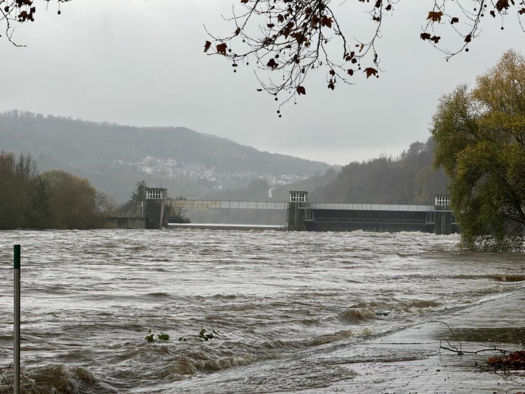
Every time we have an increase of water level, we ask ourselves “will we get flooded ? at what level should we move our items in a safer place” ?
Of course we know that 2,3m in Perl is a very safe level and we also know that 8m in Perl is a disaster. But what about 5,2m ? Is it reaching the street ? Will the Schwebsange marina parking and camping site be flooded ?
I decided to keep a log of significant levels and a description of the effects, with some charts and pictures, so that the next time we have high waters we know what to expect.
A note on the speed of the water. This incredibly interesting article describes the results of the “Determination of flow times, flow velocities, and longitudinal dispersion in the River Mosel”. The first chart at page 371 shows the average speed of the water in m/s based on the water flow.
In case of average water flow (Q/MQ=1), with average water level of 253 cm, the speed is around 0,33 m/s (1,2 km/h). We can assume1 that the average water flow in Perl is 150 m3/s.
At a water level of 305 cm with a flow of 280 m3/s, the Q/MQ would be 1,87 and the current speed would be according to the chart 0,7 m/s (2,5 km/h). This deviates significantly from the calculation in the “Example 1” below (3,75 km/h) and suggests to require therefore further analysis with additional data.
According to this chart, the LIRC limit for rowing of 350 m3/s, Q/MQ is 2,33 and the resulting current speed would be 0,8 m/s (2,9 km/h).
| Water level* | Flow* | Observed effects | Example of observation |
|---|---|---|---|
| 203 cm | According to the Elwis statistics, the minimum measured level in ten years is 203 cm | – | |
| ~220 cm | <100 m3/s | This is a tipical level of the river during drought periods. The Moselle seems more a lake, as there is hardly any current. Risk of algae in the warm season. Shallow waters on the banks can increase the risk of hitting rocks if rowing too close to the borders: if possible, row more towads the center of the river to avoid rocks and algae. Possible blue algae (Cyanobacterial proliferation). | Summer 2023 |
| 230-260 cm | 100-200 m3/s | The typical Luxembourgish Moselle most of the time. Light but noticeable current, ideal for rowing. According to the Elwis statistics, the average level in ten years is 253 cm. | Most of the time |
| ~280 cm | ~220 m3/s | Also depending on the wind direction, the current is definitely noticeable but does not pose significant difficulties to maneuver. Gig boats can pass the Schengen bridge and go closer to the lock although there is stronger current and some turbulence there. In case of strong wind from North, opposite direction from the current, pay attention as wind and current can create confused waves. | 2.12.23 |
| ~305 cm | ~280 m3/s | The current is really noticeable and makes the upstream leg quite slow. The current in proximity of the Schengen bridge, dam and lock is very strong and turbulent and causes strong drift especially when turning. Waves and choppy waters there can make a turn difficult and slower. Stand clear from obstacles and plan your maneuver with a lot of space buffer. I would not recommend these conditions for rowing in a single / skiff nor in a racing shell. Robust and stable boats and experienced crew is required to row safely, especially in the cold season. In case of wind from south, plan very carefully your session and do not row in direction North / Stadtbredimus unless your crew are very fit and have plenty of time. The return leg could be very slow and intense. Example 1: On 26.11.23 on Frauenlob, a C3x boat, in absence of wind, the average speed from Schwebsange to Schengen was 4´20″/500m (6,9 km/h) and the average speed on the way back was 2´5″/500m (14,4 km/h) for a difference of 7,5 km/h that would hint at a current speed of 3,75 km/h. This is evidently just an indication as there are several other factors that could influence the speed e.g. upstream we rowed closer to the bank and downstream more in the middle. (see image below) Example 2: With wind from south, the combined effect of wind and current can slow down the boat speed quite significantly, which means that the return leg from Stadtbredimus to Schwebsange could take 1,5+ hours ! | 26.11.23 |
| 320 cm | 350 m3/s | Limit conditions for rowing – only with a very stable boat and a particularly experienced and fit crew. To avoid in case of strong wind from south. | 30.11.2023 |
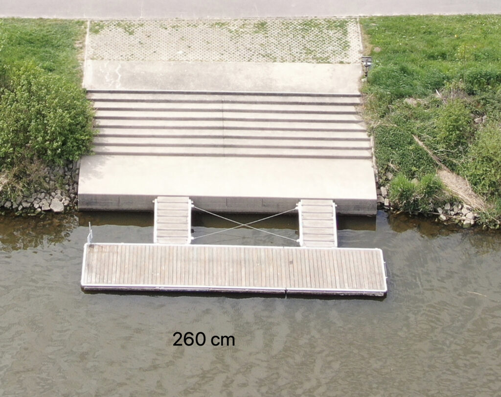
| 490 cm | 670 m3/s | – Rowing and navigation impossible – Very high water level but not yet general flooding – Roads in Schengen in front of the waterlock start flooding and are closed – The stairs of the LIRC summer pontoon have still two steps dry. The camping site is not flooded. – The floating pontoons of the Schwebsange marina are about 60-80cm higher than the concrete entry path, making quite difficult the access from land to the marina pontoon – The water level is still quite below the level of the parking of the marina See photos | 16.11.2023 11:00 |
| 520 cm | 862 m3/s | – Very high water level with start of some flooding – Roads in Schengen in front of the waterlock are flooded and closed to traffic – The stairs of the LIRC summer pontoon have no steps dry. the water reaches the level of the terrain but the camping site south side is not yet flooded. – The camping site north side is partly flooded, i.e. the camp places in front of the Lieblingsplatz / showers building are flooded – The floating pontoons of the Schwebsange marina are more than 1m higher than the concrete entry path, making impossible the access from land to the marina pontoon – The water level is still below the level of the parking of marina – The level of water at Schengen and Stadtbredimus waterlocks is so high that the lock step is not visible See photos | 17.7.2021 14:00 19.11.2023 11:00 |
| 536cm | 911 m3/s | The water reaches the Lieblingsplatz / showers building and takes progressively more space in the north side of the camping. Marina parking still above water level. See photos | 5.1.2024 13:00 |
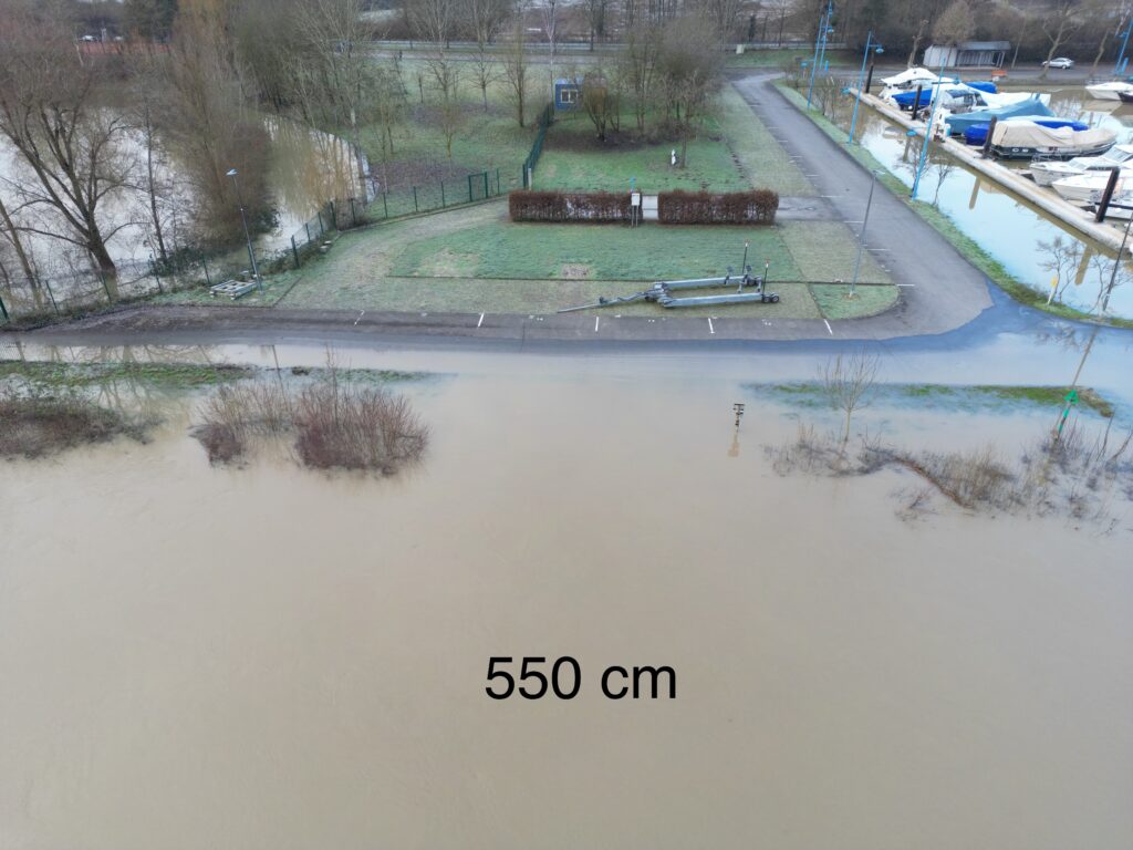
| 550 cm | 950 m3/s | Schengen and Remich road flooded, traffic diverted. Camping area partly flooded. | 11.1.2025 12:00 |
Image above: chart manually maintained of significant pairs of water level and water flow, and calculated trend line. Level and flow correlate quite consistently, although they could independently change based on the upstream and downstream waterlock settings. The red dot represent the limit conditions set by LIRC for rowing. The green dot represent a “easy rowing” conditions limit (if no other risk or challenge factors).
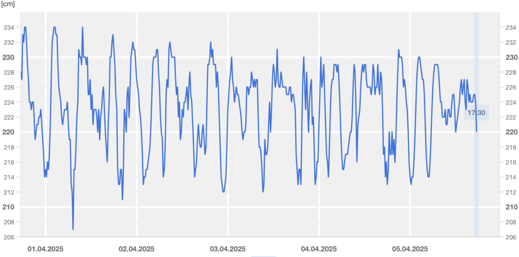
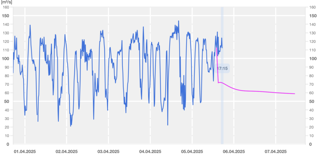
Image above: charts of very low water level and flow in April 2025. The frequent fluctuations between 212cm and 230cm (50m3/s – 130 m3/s) could be caused by flow adjustments of the Schengen and Stadtbredimus waterlocks.

Image above: Rowing session on 1.6.2024, wind from 307° (NW), wind speed 3,8-4,4m/s (14-16 km/h), wind gust 5,9-7,3 m/s (21-26 km/h), water level in Perl 304 cm (year average 253cm), water flow in Perl 330-340 m3/s (year average 150m3/s); Gig 5x boat. Typical pace upstream 4´5″/500 (6,6 km/h), typical pace downstream (excl. power drills) 2´15″/500m (13,3 km/h).


- As mentioned in this page, “Größte Durchflussmenge: Palzem 150 m3/s,” ↩︎
Leave a Reply